-

Huelva seafront promenade
-
Huelva seafront promenade
-
White snake with alveolar plates
-
Regeneration of former mining lands and pergola
-
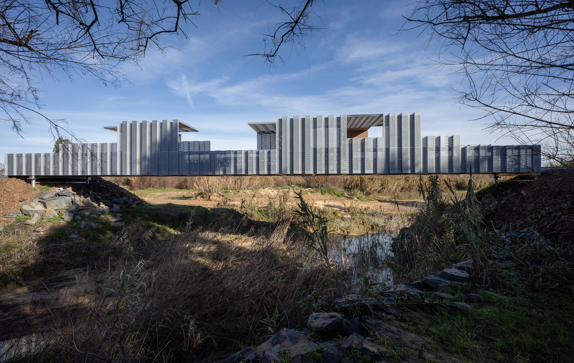
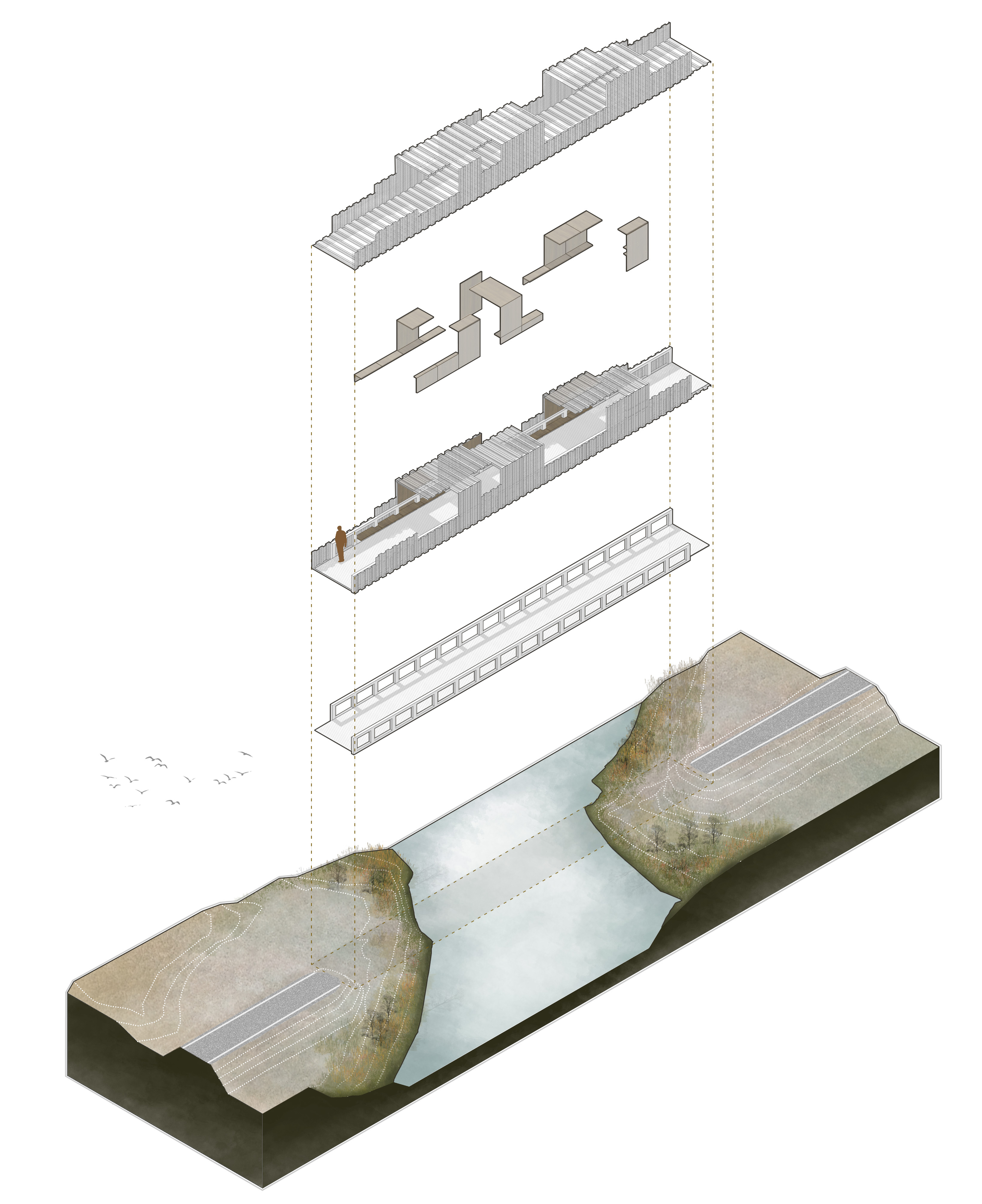
Metal Bridge over Prado river
-
Viewpoint
-
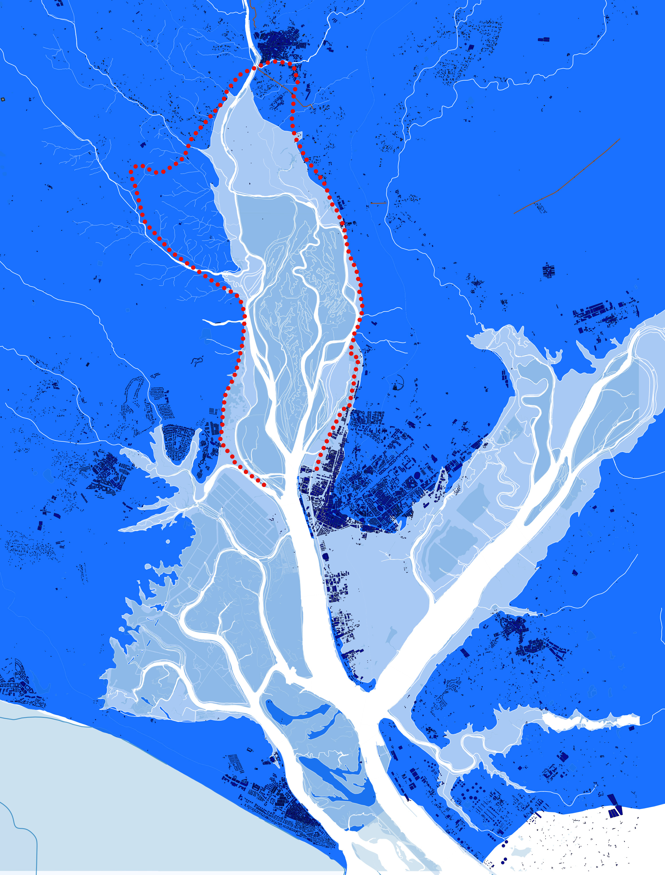
General plan of the itinerary showing the location of elements
-
The territory of water and the Itinerary
-
Axonometric projection of the pergolas
-
axonometric projection of the bridge
-
The route crossing salt flats and marshes
-
Pier section
Landscape Itinerary Around the North Estuary Of The Odiel River
Estudio Acta. Huelva, Spain
-
Name of work in English
Landscape Itinerary Around the North Estuary Of The Odiel River
-
Name of work in original language
ITINERARIO PAISAJISTICO EN TORNO AL ESTUARIO NORTE DEL RIO ODIEL. HUELVA
Prize year
EUmies Awards 2026
-
Work Location
Huelva, Spain
-
Studio
Estudio Acta
EUmies Awards 2026 Nominees


- Low cost and high impact: Sustainable multimodal route for only €28/m².
- Rehabilitation of degraded spaces and sustainability: Use of old railway tracks and integration with the Odiel Marshes.
- Scalability and replicability: Multidisciplinary nature, replicable in degraded spaces.
Collaborators
Collaborator (office): LUIS MIGUEL CORTES SANCHEZ; Collaborator (office): MARCOS MERINO; Collaborator (office): JULIA MORENO FERNANDEZ; Structure: FRANCISCO DUARTE JIMENEZ - DUARTE ASOCIADOS; Environmental: JAVIER CAMACHO VARA DE REY - TYPMA; Assistant Works Direction and Coordination in Security and Healthy: ANTONIO RIVAS PÉREZ
Program
Landscape
-
Labels
Green Belt · Regeneration · Land art
Site area
72000000 m²
-
Client
DEVELOPMENT, TERRITORIAL PLANNING AND HOUSING. GOVERNMENT OF ANDALUCIA
Total gross floor
89570 m²
Cost
28 €/m²
A 30 km long green infrastructure connecting three towns and redeveloping their degraded urban-rural edges. Starting from an infrastructure and communications project, we propose adding value to the intervention, turning it into a fully equipped park. The route runs along disused railway tracks, livestock trails, the edges of marshes and salt flats, and some urban sections. It is marked by a series of elements (pergolas, bridges, rest areas and viewpoints) which, like acupuncture points and strategically located, help to guide the route, set the pace and make the territory legible.
Citizens of the 21st century no longer live in confined spaces, with little connection to neighbouring municipalities. The Territory, as a space where life unfolds – work, residence, leisure, social relations – calls for the establishment of LINKS between the parts that make up our physical reality. The intervention is CONTAMINATED by other disciplines beyond architecture, present in the work territory, and, in addition to architecture, it involves engineering, hydraulics, infrastructure, heritage, ethnography, botany, biology, sport and even public health. The meagre budget available has forced us to sharpen our wits and concentrate our efforts on very specific points along the extensive route, to prevent the action from being diluted. Starting with an infrastructure and communications project, we added value to turn it into a fully equipped park. In short, the aim is to take advantage of a LOOP route to reflect on the future and development of the delicate territory it surrounds.
The project oscillates between the large scale of the territory and the small scale of the architectural pieces, with the medium scale commonly found in architecture barely appearing. To define its morphology and choose the materials, the strategy involves recalling the rich natural and cultural heritage of the territory and maintaining its essence: its riverside, mining and railway character, and its conception as a large viewpoint from the rural land. All of this is reflected in the use of sinuous and organic forms, the same ones that tidal nature shows us. In terms of materials, we have resorted to those historically used in this territory: breakwaters, floodgates, sheet piling, untreated wood and water crossings reinterpreted with honeycomb panels. The traces of the rich mining and railway past are reflected in the use of steel and perforated sheet metal to construct bridges, pergolas and viewpoints, hybrids between architecture and sculptures stranded in the territory.