-

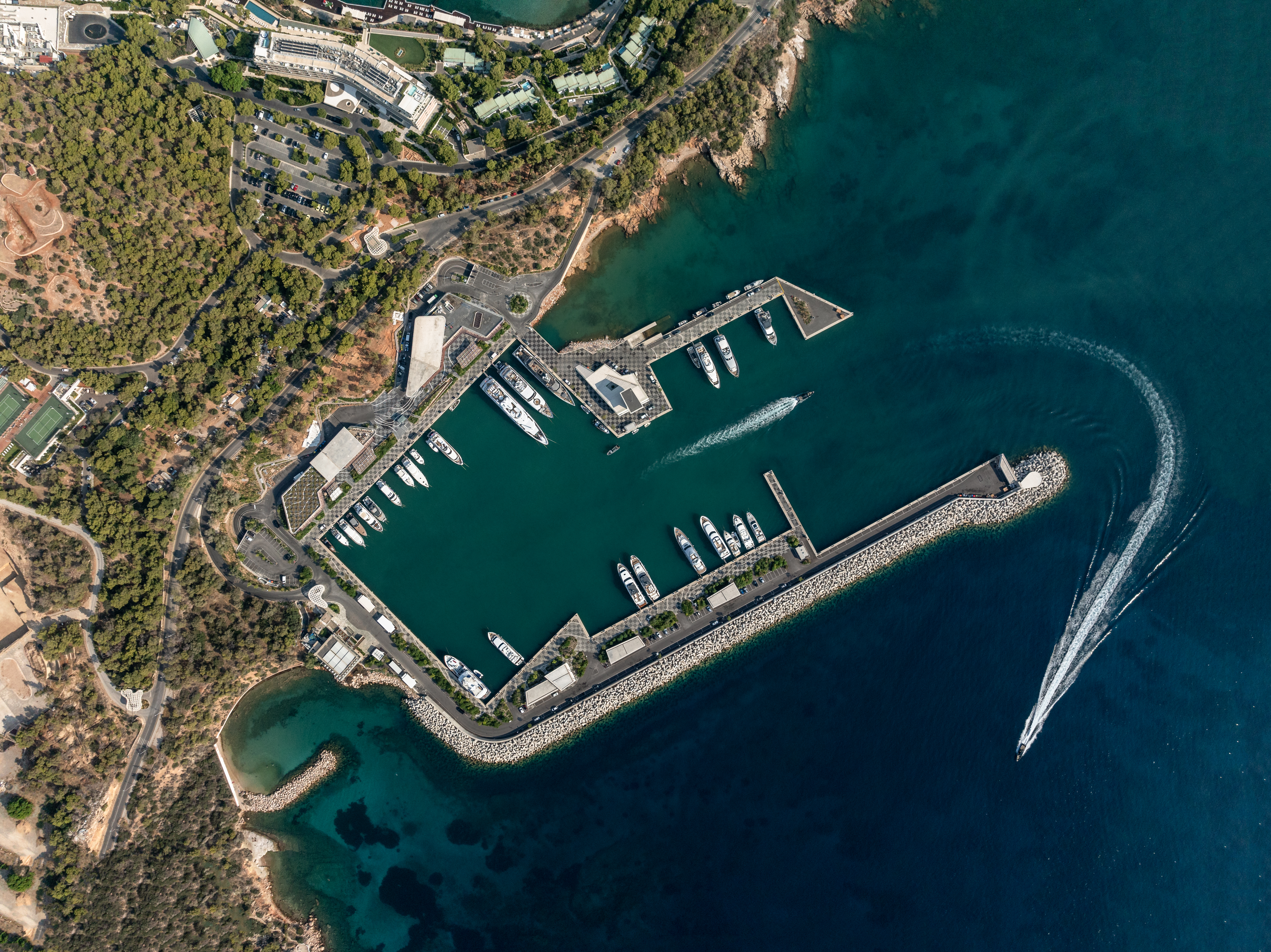
Aerial Overall View of Astir Marina
-
Waterfront Promenade, with Green Buffer separating the marine edge from the parking lots
-
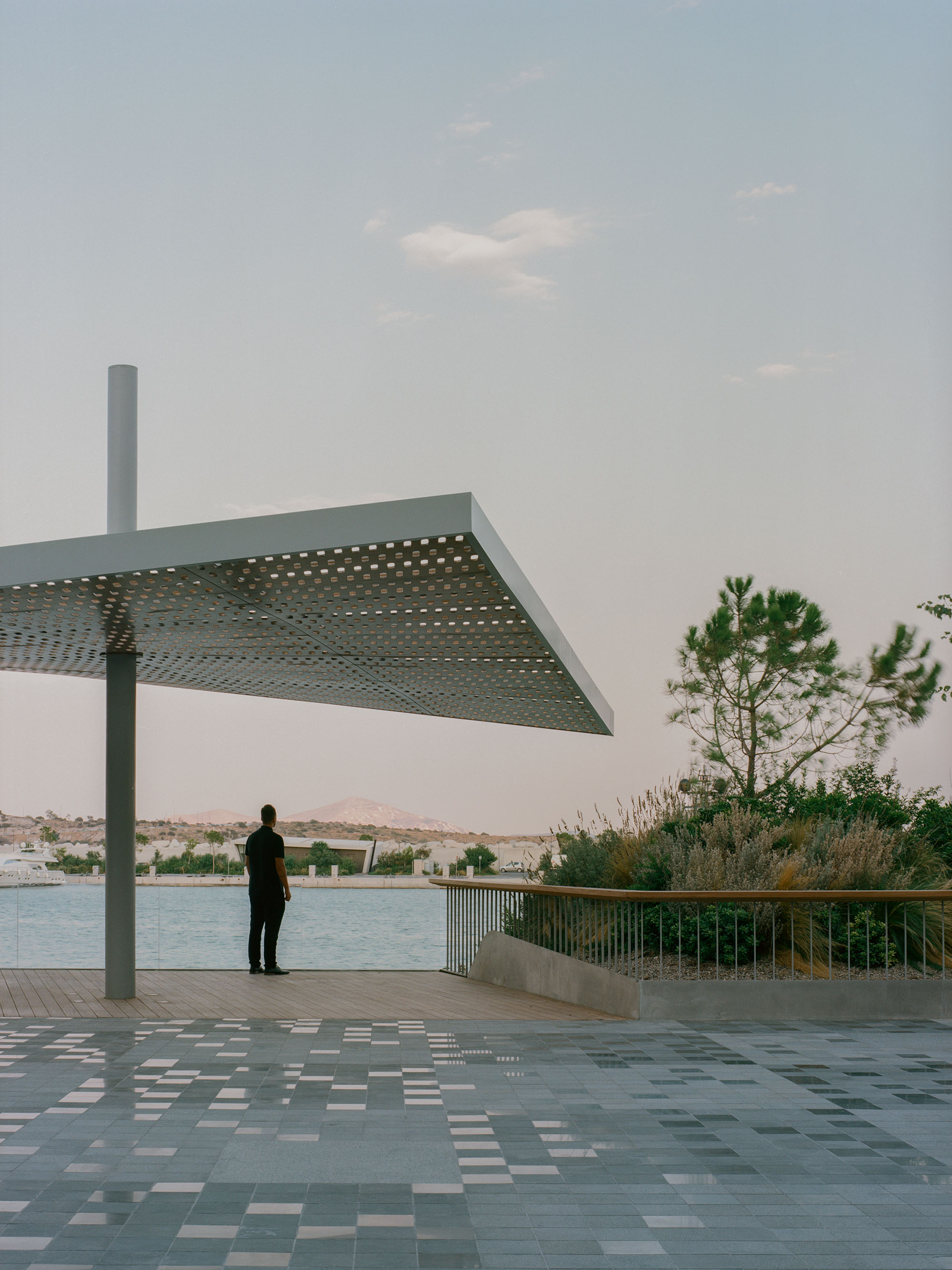
Shading Pergola, Green Island, and Plaza Grid
-
Aerial View of Hardscape with Grid and Topographic Contours, Green Islands, Water Feature, and Steps
-
Olive Tree mound at central plaza, with contour line in foreground
-
Detail of Hardscape, Contour Lines formed from Marble Offcuts, Grid from Portuguese Pavers
-
Axonometric - Zoom Detail at Central Plaza and path to Hotel
-
Overall Axonometric
-
Zoom Axon of Key Elements - Waterfront shared surface, grid, contours, and green islands
-
Section through Windward Pier showing Green Buffer between Waterfront Promenade and Car Parking
-
Exploded Axonometric showing different systems and elements of the Landscape Design
-
Concept Plan showing various forces at play on the site that influenced the design
Astir Marina Landscape and Public Realm
NEIHEISER ARGYROS. Athens, Greece
-
Name of work in English
Astir Marina Landscape and Public Realm
-
Name of work in original language
ΜΑΡΙΝΑΣ ΑΣΤΕΡΑΣ
Prize year
EUmies Awards 2026
-
Work Location
Athens, Greece
-
Studio
NEIHEISER ARGYROS
EUmies Awards 2026 Nominees


Collaborators
Program
Landscape
-
Labels
Gardens & Parks · Structure · Regeneration · Land art · Facilities
Site area
60000 m²
-
Client
Astir Marina Vouliagmenis S.A.
Total gross floor
60000 m²
Located on the southern coast of Athens, the 6-hectare Astir Marina is a new waterfront development providing 60 berths, retail, restaurants, and marina amenities. The design reinterprets the marina as a layered territorial map, integrating historic contours, marine ecologies, and engineering data to generate its topography and spatial logic. Native planting and coastal ecologies define a soft, shaded waterfront of pedestrian routes, connecting people to the water and softening the marina’s hard edges. The result is a hybrid environment — a waterfront park that also happens to be a marina — where landscape, ecology, and infrastructure are conceived as one continuous system.
One way to approach designing the artificial landscape of a marina is as a blank site—a tabula rasa—but in reality, the sea conceals complex ecosystems continuous with the visible ground and hidden just below the water. We explored ways of representing this submerged landscape, drawing inspiration from nautical maps with topographic contours—traces of terrain projected onto a flat surface. Using World War II aerial scans, we mapped the site’s original beaches, coves, islands, and seabed topography, layering these historic contours onto the new engineered land of the marina to create a compelling graphic framework for the project. Another key driver was our analysis of existing marinas, which are often harsh, infrastructural spaces dominated by concrete and cars. For Astir Marina, we relocated primary parking to the rear of the site, behind a green buffer of planted mounds—an archipelago of “green islands” that softens the relationship between public space, landscape, ecology, and marina infrastructure.
There are four main elements to the design - a 2m grid, the historic contour lines, the green islands, and the retaining wall at the back of the site. 1) Grid: Rotated 23 degrees to align with the central basin, this site-wide grid uses a material hierarchy—honed basalt stone near retail buildings, Portuguese pavers at the waterfront promenade, and two-colored asphalt for roads—creating shared car-pedestrian surfaces that minimize kerbs and prioritize walkability. 2) Contours: Marble offcuts from nearby quarries form contour lines mapping the historic seabed topographic lines. Polished smooth like terrazzo on the main plaza and left rougher elsewhere, they create a striking graphic contrast against the ordered grid. 3) Green Islands: Lush planted mounds act as green buffers that separate cars from the water's edge, transforming the harsh marina environment into a pleasant waterfront public realm. Each three-dimensional mounded island has a unique geometry, creating a surreal new topography and immersive public landscape. 4) Retaining Wall: Gabion walls with stratified stones (smallest to largest, bottom to top) form terraced habitats along the 4-6m slope. Inspired by Greek agricultural walls, they retain earth and shape paths that link the adjacent hotel to the marina while supporting local wildlife.